More Techno Geek Stuff
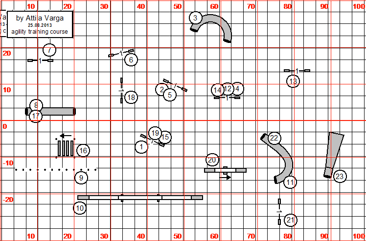
I've been running international courses for a year or two now. Since I can't set a course without my surveyors tape and wheel, I spend a lot of time converting photos of metric course maps to feet in CRCD. I finally decided to try and overlay a grid marked in feet over a metric course map.
The course map I used was in .PNG format, so I converted it to the more common JPEG format in PhotoShop to see if this would work with a JPEG image.
Next I created a 40 meter x 20 meter grid in CRCD.
Then I switched off metric in the view menu and had a blank course map marked off in feet. I saved it in .PNG format so that I would have a transparent background when I removed the white areas.
Then I opened my grid in PhotoShop. In order to work with the image, you have to change from indexed color to RGB and convert the background to a layer. Then you can use the magic wand tool and remove all the white.
Next select Inverse and paint the lines and numbers red to make it easier to see them when you overlay this image on the original course map. Select the entire image and copy.
Paste it over the original course map and voila.
Since I am working in layers, I decided I might as well move the foot grid to the right so that the course fits within an 80x100 foot grid.
Here's my finished course map:


Rose,
ReplyDeleteI sure it works great. I use the low tech approach. I calculate how much I have to enlarge the metric map so that ten feet matches the grid lines of my Clean Run clip board. Not fancy but it works.
Bill